
We are extremely excited that the top performer in Lidar and 3D mapping has placed their trust in us and recognized us as the ideal UAS company to incorporate their systems into our drones. Our extensive background and extensive knowledge give us an edge over our rivals in the aerospace industry. Our drones have been specifically designed to be the largest portable drones available, boasting an outstanding flight duration and a remarkable capacity for carrying heavy payloads.
At Skypro UAV, we couldn’t be more thrilled and honored that the industry-leading player in Lidar and 3D mapping has chosen to place their trust in us. Their confidence in our capabilities as the perfect UAS (Unmanned Aerial Systems) company to integrate their cutting-edge systems into our drones is a testament to our expertise and commitment to excellence.
With our long-standing experience in the aerospace industry, we have solidified our position as a frontrunner, constantly pushing the boundaries of what is possible in unmanned aerial technology. Our team of skilled engineers, technicians, and researchers possesses a wealth of knowledge and a passion for innovation that sets us apart from our competitors. We have dedicated countless hours to refining our drone designs, ensuring that they meet the highest standards of performance, reliability, and functionality.
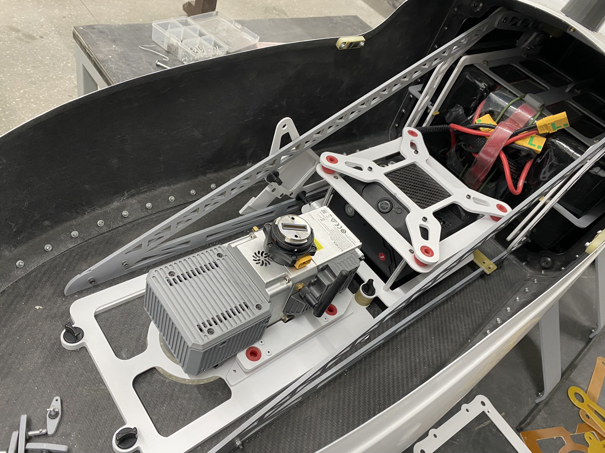
One of our proudest achievements is the development of the largest portable drones in the market. These groundbreaking aerial vehicles have been meticulously crafted to combine unmatched flight duration with an impressive capacity for carrying heavy payloads. We understand the importance of efficiency and endurance in the world of aerial mapping and surveying, where every minute in the air counts. Our drones offer extended flight times, enabling our clients to cover larger areas and capture more data in a single mission
The integration of the leading player’s Lidar and 3D mapping systems into our drones is a game-changer. Lidar technology, which stands for Light Detection and Ranging, allows for incredibly precise measurements and detailed mapping of landscapes, buildings, and objects. By seamlessly integrating this advanced technology into our drones, we provide our clients with a comprehensive solution for their aerial mapping and surveying needs.
This achievement serves as a testament to our unwavering commitment to innovation, excellence, and customer satisfaction. We will continue to push the boundaries of what is possible in the unmanned aerial systems industry, striving to deliver state-of-the-art solutions that make a meaningful impact in humanitarian and emergency response efforts.
In conclusion, winning the project to deliver the latest modular flagship to the RED CROSS with Lidar and 3D mapping integration is a crowning achievement for us. It showcases the culmination of our hard work, expertise, and dedication to pushing the boundaries of what drones can accomplish. We are incredibly proud and deeply honored to play a vital role in supporting the RED CROSS’s life-saving initiatives and making a positive difference in the world.
